
List of former transcontinental countries
This article needs additional citations for verification. (January 2019) |
This is a list of transcontinental former countries, i.e. countries which covered land on two or more continents, including islands associated with a continent other than the one where the country was based. The examples below are listed in chronological order[dubious – discuss] with the number of continents covered in parentheses and the country's primary continent listed first. When a timespan is included, it is the time period in which the country was transcontinental.
BC
[edit]- Ancient Egyptian Empire (2) – Africa, Asia,[1]
- Sabaeans (2) – Asia, Africa[4]
- Cimmerians (2) – Europe, Asia (late 8th century BC) [map]
- Assyria (2) – Asia, Africa (671–612 BC) [map]
- Neo-Babylonian Empire (2) – Asia, Africa (567–539 BC)[5]
- Achaemenid Empire (3) – Asia, Europe, Africa [map]
- Carthage (2) – Africa, Europe[6]
- Alexander the Great (3) – Europe, Asia, Africa (334–323 BC) [map]
- Ptolemaic Kingdom (3) – Africa, Asia, [map][7] Europe (at its peak) [map]
- Lysimachian Kingdom (2) – Europe, Asia (306–281 BC) [map]
- Seleucid Empire (2) – Asia, Europe (281 BC [map] and 196–191 BC [map])
- Roman Empire (3) – Europe, Asia, Africa [map]
![[map]](/w/index.php?title=File:CAUC20EARLIEST.jpg&action=edit&redlink=1)
![[map]](/wiki/File:Map_of_Assyria.png)
![[map]](/wiki/File:Achaemenid_Empire.jpg)
![[map]](/wiki/File:MacedonEmpire.jpg)
![[map]](/wiki/File:Diadochen1.png)
![[map]](/wiki/File:LocationRomanEmpire.png)
AD 1–AD 500
[edit]- Sarmatians (2) – Europe, Asia [map]
- Kingdom of Aksum (2) – Africa, Asia[8][map]
- Himyarite Kingdom (2) – Asia, Africa[8]
- Palmyrene Empire (2) – Asia, Africa (260–273)
- Hunnic Empire (2) – Europe, Asia [map]
- Byzantine Empire (3) – Europe, Asia, Africa [map]
- Western Roman Empire (2) – Europe, Africa (395–476) [map]
- Vandal Kingdom (2) – Europe, Africa [map][9]
- Ostrogoths (2) – Europe, Africa[10]
![[map]](/wiki/File:Map_of_Colchis,_Iberia,_Albania,_and_the_neighbouring_countries_ca_1770.jpg)
![[map]](/wiki/File:LocationAksumiteEmpire.png)
![[map]](/wiki/File:Huns_empire.png)
![[map]](/wiki/File:EasternRomanEmpire.png)
![[map]](/wiki/File:Extent_of_Western_Roman_Empire_395.png)
![[map]](/wiki/File:Invasions_of_the_Roman_Empire_1.png)
500–1000
[edit]- Sabirs (2) – Europe, Asia
- Sassanid Empire (2) – Asia, Africa, (618–641) [map]
- First Turkic Khaganate[11] (2) – Asia, Europe
- Islamic Caliphate
- Rashidun Caliphate (2) – Asia, Africa (639–661) [map]
- Umayyad Caliphate (3) – Asia, Africa, Europe (661–750) [map]
- Abbasid Caliphate (3) – Asia, Africa, Europe (750–940)[12]
- Alanian Empire (2) – Europe, Asia [map]
- Khazar Empire (2) – Europe, Asia[13]
- Emirate of Córdoba (2) – Europe, Africa[14]
- Pechenegs (2) – Europe, Asia [map]
- Shailendra dynasty (2) – Asia, Oceania
- Kingdom of Kakheti (2) – Asia, Europe
- Kingdom of Abkhazia (2) – Asia, Europe
- Aghlabid Emirate (2) – Africa, Europe (827–909)[15]
- Tulunid Emirate (2) – Africa, Asia (877–904) [map]
- Sajid Emirate of Azerbaijan (2) – Asia, Europe[16]
- Fatimid Caliphate (3) – Africa, Asia, [map] Europe [map]
- Rus (2) – Europe, Asia (at its peak during the Caspian expedition of 913) [map]
- Caliphate of Córdoba (2) – Europe, Africa[17]
- Ikhshidids (2) – Africa, Asia (935–969) [map]
![[map]](/wiki/File:Sassanid-empire-610CE.png)
![[map]](/wiki/File:Rashidmap.gif)
![[map]](/wiki/File:Age_of_Caliphs.png)
![[map]](/wiki/File:Khazar0.png)
![[map]](/wiki/File:Khazarfall1.png)
![[map]](/wiki/File:Tulunid_Emirate_868_-_905_(AD).PNG)
![[map]](/wiki/File:Fatimids_Empire_909_-_1171_(AD).PNG)
![[map]](/wiki/File:Rus_Caspian.png)
![[map]](/wiki/File:Ikhshidid_Dynasty_935_-_969_(AD).PNG)
1000–1450
[edit]- Sallarid Emirate of Azerbaijan (2) – Asia, Europe[18]
- Kalbid Emirate of Sicily (2) – Europe, Africa[17]
- Georgian Empire (2) – Asia, Europe [map]
- Almoravid Empire (2) – Africa, Europe [map]
- Seljuqs (2) – Asia, Europe [map]
- Pisa (3) – Europe,[19] Asia, Africa [map]
- Kediri Empire (2) – Asia, Oceania [map]
- Chola Empire (2) – Asia, Oceania (at its peak circa 1050) [map]
- Kingdom of Sicily (2) – Europe, Africa[20]
- Almohad Empire (2) – Africa, Europe[20]
- Kingdom of Jerusalem (2) – Asia, Africa (1164 and 1167) [map]
- Ayyubid Sultanate (2) – Asia, Africa (1169–1250) [map]
- Shirvanshah Empire (2) – Asia, Europe[21]
- Latin Empire (2) – Europe, Asia (1204–1261) [map]
- Venice (2) – Europe, Asia [map][22]
- Second Bulgarian Empire (2) – Europe, Asia (at its peak) [map]
- Khwarezmian Empire (2) – Asia, Europe (at its peak)[23]
- Mongol Empire (2) – Asia, Europe [map] (largest empire of contiguous land ever)
- Golden Horde (2) – Europe, Asia [map]
- Empire of Nicaea (2) – Asia, Europe [map]
- Mamluk Empire (2) – Africa, Asia[24]
- Majapahit Empire (2) – Asia, Oceania [map][25]
- Ilkhanate (2) – Asia, Europe (1255–1335)[26]
- Genoese Empire (2) – Europe, Asia[27][map]
- Aragonese Empire (2) – Europe, Africa [map][map]
- Marinid Sultanate (2) – Africa, Europe (1294–1344) [map]
- Ottoman Empire (3) – Asia, Europe, Africa [map]
- Buginese Empire (2) – Oceania (including northern Australia), Asia
- Timurid Empire (2) – Asia, Europe[28]
- Nogai Horde Empire (2) – Asia, Europe[29]
- Castilian Empire (2) – Europe, Africa [map]
- Kara Koyunlu Empire (2) – Asia, Europe [map]
- Kingdom of Norway (872–1397) (2) – Europe, North America [map]
![[map]](/w/index.php?title=File:Geor_david.gif&action=edit&redlink=1)
![[map]](/wiki/File:Almoravid-empire-en.svg)
![[map]](/wiki/File:Seldschuken-Reich-map.png)
![[map]](/wiki/File:Southeast_Asia_trade_route_map_XIIcentury.jpg)
![[map]](/wiki/File:LocationChola_empire_sm.png)
![[map]](/wiki/File:Ayyubid.png)
![[map]](/wiki/File:LatinEmpire.png)
![[map]](/wiki/File:2nd_Bulgarian_empire_map_LOC.jpg)
![[map]](/wiki/File:Mongol_dominions1.jpg)
![[map]](/wiki/File:Golden_Horde_1389.svg)
![[map]](/wiki/File:Epir1252-1315.png)
![[map]](/wiki/File:Majapahit_Empire.svg)
![[map]](/wiki/File:Eastern_Mediterranean_1450_.svg)
![[map]](/wiki/File:Aragonese_Empire.PNG)
![[map]](/wiki/File:Marinid_dynasty_1258_-_1420_(AD).PNG)
![[map]](/wiki/File:Ottoman_1683.png)
![[map]](/w/index.php?title=File:Qara_Qoyunlu_Turcomans_1407%E2%80%931468_(AD).PNG&action=edit&redlink=1)
![[map]](/w/index.php?title=File:Norwegian_Hereditary_Empire_excluding_Greenland.PNG&action=edit&redlink=1)
1450–1700
[edit]- Portuguese Empire (6) – Europe, Asia, Africa, North America, South America, Oceania [map][map] (from 1808 to 1821, its capital was in Rio de Janeiro)
- Mahra Sultanate (2) – Asia, Africa [map]
- Spanish Empire (6) – Europe, Asia, Africa, North America, South America, Oceania [map]
- Kingdom of Denmark-Norway (4) – Europe, Asia, North America, Africa [map]
- German Empire (4) – Europe, South America, [map] Asia, [map] Africa [map]
- Guna people (2) – North America, South America (the Guna people were living in what is now Northern Colombia and the Darién Province of Panama, including the Darién Gap (the border between North and South America), at the time of the Spanish invasion in the early 1500s)
- Iberian Union Empire (6) – Europe, Asia, Africa, North America, South America, Oceania (1580–1640) [map]
- British Empire (6) – Europe, Asia, Africa, North America, South America, Oceania. [map]
- Dutch Empire (6) – Europe, Asia, Africa, North America, South America, Oceania [map]
- French Empire (6) – Europe, Asia, Africa, North America, South America, Oceania [map]
- Scotland (2) – Europe, North America (1621–1631) [map]
- Swedish Empire (3) – Europe, North America, [map] [map] Africa [map]
- Courland (3) – Europe, Africa, South America (1651–1689) (a dependency of Poland–Lithuania) [map]
- Knights of Malta (3) – Europe, Africa, North America (1530–1551 and 1651–1665)
- Brandenburg-Prussia (3) – Europe, Africa, [map][map] North America [map] (1682–1721)
![[map]](/wiki/File:Portuguese_empire.png)
![[map]](/wiki/File:Portugal_XVIII.png)
![[map]](/wiki/File:Spanish_Empire.png)
![[map]](/wiki/File:British_Empire_1897.jpg)
![[map]](/wiki/File:DutchEmpire.png)
![[map]](/wiki/File:Anachronous_map_of_the_All_French_Empire_(1534_-1970).png)
![[map]](/wiki/File:Nya_Sverige.png)
Since 1700
[edit]- British Empire (7) – (English Empire until 1707) Asia, Oceania, Africa, Europe, South America, North America, Antarctica
- Omani Empire (2) – Asia, Africa[30] (from 1840 to 1856, Said bin Sultan had the capital in Stone Town, Zanzibar)
- Kingdom of Piedmont-Sardinia (2) – Europe, Africa (1714–1718)[31]
- Russian Empire (3) – Europe, Asia, North America [map]
- United States of America (5) – North America, Africa (1810–1814), [map] Asia (1898-1945), Oceania, South America (1898–1979) [map][map]
- Argentina (5) – South America, Antarctica, Africa (1810-1815), North America (occupied California from November 23 to November 29, 1818), Asia (occupied Manila from 31 January to 30 March 1818)
- Mexico (2) - North America, Oceania
- Chile (3) - South America, Antarctica, Oceania
- Ecuador (2) - South America, Oceania
- Portugal (3) - Europe, Africa, North America
- Kingdom of the Two Sicilies (2) – Europe, Africa (1816–1860) [map]
- Kingdom of Italy (2) – Europe, Africa (1861–1889)[31][map]
- German Empire (4) – Europe, Africa, Oceania, Asia (1884–1919) [map]
- Belgium (2) – Europe, Africa (1908–1962) [map]
- Denmark (4) – Europe, North America, Asia, Africa [map]
- Japanese Empire (3) – Asia, Oceania (1898–1945), North America (1943) [map][map]
- Norway (2) – Europe, Antarctica [map]
- France (7) – Europe, Africa, Asia, North America, South America, Oceania, Antarctica (1830–1962)
- Commonwealth of Australia (3) – Oceania, Asia, Antarctica[32][map]
- Union of South Africa (1948–1961) and Republic of South Africa (2) – Africa, Antarctica (if the Prince Edward Islands are considered Antarctic islands)
- United Kingdom of Portugal, Brazil and the Algarves (5) – Europe, South America, Africa, Asia, Oceania
- Uzbek Khanate (2) – Asia, Europe[33]
- Ak Koyunlu Empire (2) – Asia, Europe [map]
- Khanate of Sibir (2) – Asia, Europe [map]
- Astrakhan Khanate (2) – Europe, Asia[34]
- Safavid Empire (2) – Asia, Europe[35][map]
- Crimean Khanate (2) – Europe, Asia (at its peak)[36]
- Grand Duchy of Moscow [map] and Tsardom of Russia[37] (2) – Europe, Asia
- Kalmyk Khanate (2) – Asia, Europe[38][map]
- Kingdom of Bali (2) – Asia, Oceania [map]
- Afsharid Empire (2) – Asia, Europe (1736–1747)
- Kazakh Khanate (2) – Asia, Europe[39]
- Quba Khanate (2) – Europe, Asia (1747–1806)[40]
- Kingdom of Kartl-Kakheti (2) – Asia, Europe (1762–1801)[40]
- Qajar Empire (2) – Asia, Europe (1794–1813)[41][map]
- Later Egyptian Empire (3) – Africa, Asia, Europe (1803–1807 and 1833–1882)[24] [map]
- United Provinces of New Granada (2) – South America, North America (1810–1816)
- Gran Colombia (2) – South America, Central America (1819–1831) [map]
- Republic of the New Granada (1831–1858) and Granadine Confederation (1858–1863) (2) – South America, Central America [map]
- Greece (2) – Europe, Asia (1920 – 1923) [map] [map]
- Alash Orda (2) – Asia, Europe (December 1917 – May 1920)
- Transcaucasian Democratic Federative Republic (2) – Asia, Europe (February 24 – May 28, 1918) [map]
- Mountainous Republic of the Northern Caucasus (2) – Europe, Asia (March 6, 1917 – November 30, 1922)
- Azerbaijan Democratic Republic (2) – Asia, Europe (May 28, 1918 – April 28, 1920) [map]
- Democratic Republic of Georgia (2) – Asia, Europe (May 28, 1918 – February 25, 1921) [map]
- Centrocaspian Dictatorship (2) – Asia, Europe (August 1 – September 15, 1918)
- Russian SFSR (2) – Europe, Asia (November 1917 – December 1991) [map]
- Soviet Union (2) – Europe, Asia (December 1922 – December 1991) [map]
- West Indies Federation (2) – North America, South America (1958–1962) [map]
- United Arab Republic [map] and United Arab States (2) – Africa, Asia (1958–1961)
- Protectorate of South Arabia (1963–1967), People's Republic of South Yemen (1967–1970), and People's Democratic Republic of Yemen (1970–1990) (2) – Asia, Africa
- Federation of Arab Republics (2) – Africa, Asia (1972–1977) [map]
![[map]](/wiki/File:Imperio_Ruso.PNG)
![[map]](/wiki/File:GreaterAmericaMap.jpg)
![[map]](/wiki/File:Mappa_Due_Sicilie.PNG)
![[map]](/wiki/File:Italian_empire_1940.PNG)
![[map]](/wiki/File:Deutsche_Kolonien.PNG)
![[map]](/wiki/File:Belgian_colonial_empire.png)
![[map]](/wiki/File:Denmark-Norway_and_possessions.png)
![[map]](/wiki/File:Japanese_Empire2.png)
![[map]](/wiki/File:PacificTheaterAug1942.jpg)
![[map]](/wiki/File:Uzunhasanempire.gif)
![[map]](/wiki/File:Siberian_Khanate_map_English.svg)
![[map]](/wiki/File:LocationSafavid.PNG)
![[map]](/w/index.php?title=File:Muscovy-Russia_1300-1796.jpg&action=edit&redlink=1)
![[map]](/wiki/File:Kalmykia_1720.jpg)
![[map]](/wiki/File:Gulistan-Treaty.jpg)
![[map]](/wiki/File:Gran_Colombia_map.jpg)
![[map]](/wiki/File:LocationColombiaPanama.png)
![[map]](/wiki/File:Greekhistory.GIF)
![[map]](/wiki/File:Russia_Caucusus_1882.jpg)
![[map]](/w/index.php?title=File:AzerbaijanDemocraticRepublicMap.png&action=edit&redlink=1)
![[map]](/w/index.php?title=File:DRGMap.png&action=edit&redlink=1)
![[map]](/wiki/File:Soviet_Union_-_Russian_SFSR.svg)
![[map]](/wiki/File:Soviet_Union_Administrative_Divisions_1989.jpg)
![[map]](/w/index.php?title=File:West_Indies_Federation.PNG&action=edit&redlink=1)
![[map]](/wiki/File:LocationUnitedArabRepublic.png)
![[map]](/wiki/File:Esl.PNG)
See also
[edit]- List of medieval great powers
- List of Bronze Age states
- List of Classical Age states
- List of former sovereign states
- List of empires
- List of Iron Age states
- List of former monarchies
- List of largest empires
- List of states during Late Antiquity
- Middle Eastern empires
References
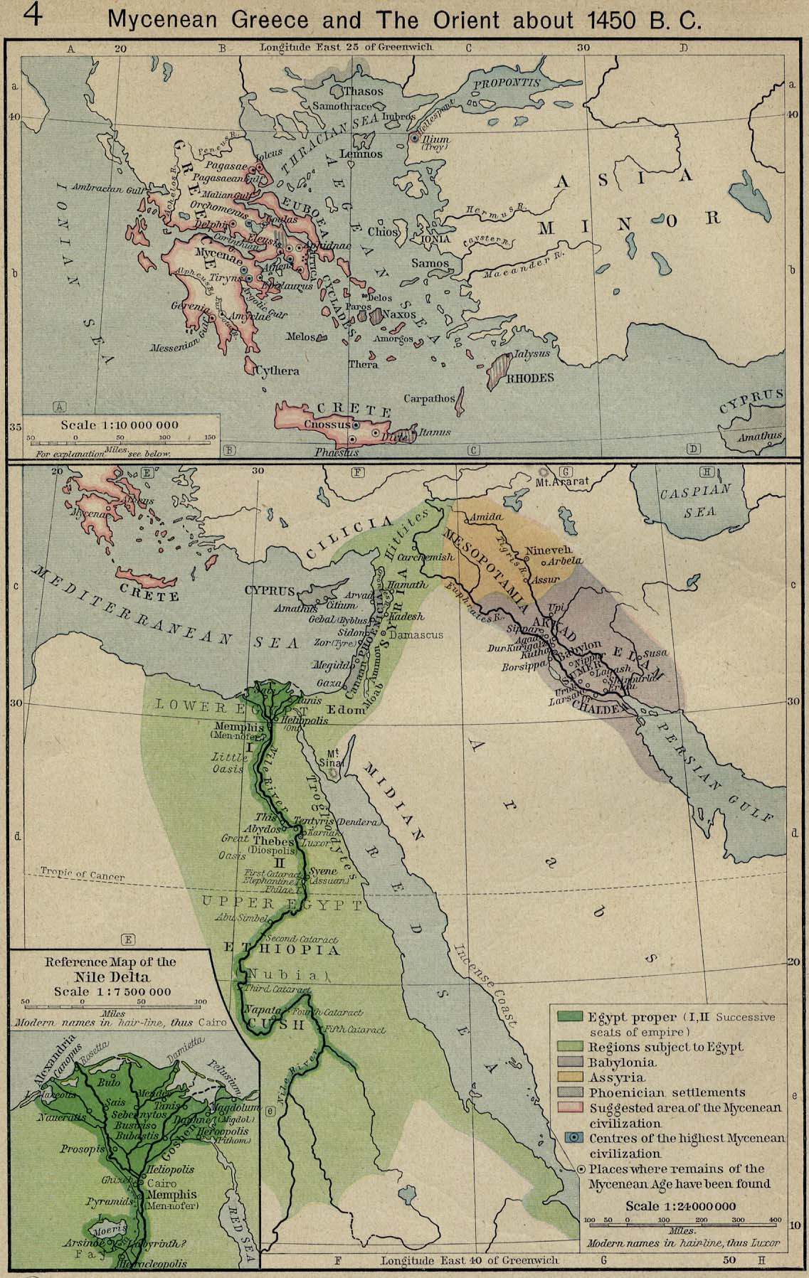
[edit]- ^ "Mycenean Greece and The Orient about 1450 B. C."
- ^ "Egyptian History: Dynasties 12 to 17 – The Middle Kingdom and the rule of the Hyksos". Reshafim.org.il. Retrieved 2010-03-16.
- ^ "2 Chronicles 14:2–15; – Passage Lookup — New International Version". BibleGateway.com. Retrieved 2010-03-16.
- ^ "The link between the ancient Yemeni kingdom and the ancient Slovenian State of Carantania uncovered: - from Marib to Carantania - culture - Yemen Times". Archived from the original on 2007-07-30. Retrieved 2007-05-29.
- ^ "Babylon". Enhancedweb.com. Retrieved 2010-03-16.
- ^ "Rome: The Carthaginian Empire in the Third Century BC". Wsu.edu:8080. 1999-06-06. Archived from the original on 2010-05-27. Retrieved 2010-03-16.
- ^ "Archived copy". Archived from the original on 2012-03-24. Retrieved 2007-06-21.
{{cite web}}: CS1 maint: archived copy as title (link) - ^ a b "thearabhistory.com". thearabhistory.com. Archived from the original on 2007-09-28. Retrieved 2010-03-16.
- ^ "Map of Europe, Southwest 500". Euratlas.com. 2007-01-13. Retrieved 2010-03-16.
- ^ "Complete Map of Europe, Year 500". Euratlas.com. 2007-01-13. Retrieved 2010-03-16.
- ^ Peter Benjamin Golden, (2010), Central Asia in World History, p. 49
- ^ "Complete Map of Europe, Year 800". Euratlas.com. 2007-01-13. Retrieved 2010-03-16.
- ^ "Yahoo | Mail, Weather, Search, Politics, News, Finance, Sports & Videos". Archived from the original on 2009-10-27.
- ^ Euratlas. "Map of Southwestern Europe in Year 800". Euratlas.com. Retrieved 2010-03-16.
- ^ Euratlas. "Map of Southwestern Europe in Year 900". Euratlas.com. Retrieved 2010-03-16.
- ^ Euratlas. "Map of Southeastern Europe in Year 900". Euratlas.com. Retrieved 2010-03-16.
- ^ a b Euratlas. "Map of Southwestern Europe in Year 1000". Euratlas.com. Retrieved 2010-03-16.
- ^ Euratlas. "Map of Southeastern Europe in Year 1000". Euratlas.com. Retrieved 2010-03-16.
- ^ "Map of Europe, Southwest 1100". Euratlas.com. 2007-01-13. Retrieved 2010-03-16.
- ^ a b Euratlas. "Map of Southwestern Europe in Year 1200". Euratlas.com. Retrieved 2010-03-16.
- ^ Euratlas. "Map of Southeastern Europe in Year 1200". Euratlas.com. Retrieved 2010-03-16.
- ^ "Map of Europe in 1550". www.zum.de. Archived from the original on 7 November 2023.
- ^ "Map of the Khwarezmian Empire in 1220". www.zum.de. Archived from the original on 14 October 2023.
- ^ a b "WHKMLA : Historical Atlas, Modern Egypt Page". Zum.de. Retrieved 2010-03-16.
- ^ "Map of Asia in 1500". www.zum.de. Archived from the original on 14 October 2023.
- ^ "Map of the Ilkhanate in 1300". www.zum.de. Archived from the original on 14 October 2023.
- ^ "Complete Map of Europe, Year 1400". Euratlas.com. 2007-01-13. Retrieved 2010-03-16.
- ^ "Yahoo | Mail, Weather, Search, Politics, News, Finance, Sports & Videos". Archived from the original on 2009-10-27.
- ^ "Map of the Golden Horde in 1480". www.zum.de. Archived from the original on 14 October 2023.
- ^ "Map of Africa in 1830". www.zum.de. Archived from the original on 14 October 2023.
- ^ a b "WHKMLA : Historical Atlas, Sicily Page". Zum.de. Retrieved 2010-03-16.
- ^ "Australian External Territories". www.britannica.com. Archived from the original on 10 December 2007.
- ^ "Map of the Golden Horde in 1440". www.zum.de. Archived from the original on 14 October 2023.
- ^ "Complete Map of Europe, Year 1500". Euratlas.com. 2007-01-13. Retrieved 2010-03-16.
- ^ Euratlas. "Map of Southeastern Europe in Year 1500". Euratlas.com. Retrieved 2010-03-16.
- ^ "WHKMLA : Historical Atlas, Crimean Tatars Page". Zum.de. 2005-02-22. Retrieved 2010-03-16.
- ^ "WHKMLA : Historical Atlas, Siberia Page". Zum.de. Retrieved 2010-03-16.
- ^ "WHKMLA : Historical Atlas, Kalmykia Page". Zum.de. 2005-02-23. Retrieved 2010-03-16.
- ^ "WHKMLA : Historical Atlas, Kazakhstan Page". Zum.de. Retrieved 2010-03-16.
- ^ a b Euratlas. "Map of Southeastern Europe in Year 1800". Euratlas.com. Retrieved 2010-03-16.
- ^ "Iran (Persia), 1800-1900 A.D. | Timeline of Art History | the Metropolitan Museum of Art". www.metmuseum.org. Archived from the original on September 30, 2007.